Most of you have probably noticed that there are four different raster map layers in http://www.peoplesmap.com/, but what do these maps represent and how can you use them?
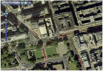
1) The Getmapping Imagery layer contains the aerial photographs used as the base to create our mapping data from.
2) The People's Map layer contains all the verified map data and information created by our various private or commercial contributors. This map only contains data that was verified by our team of professional cartographers and will therefore be visible in the People's Map WMS layer used in GIS applications or our Open Layers API embedded into customer's web sites.

3) The People's Map Unverified Layer contains both map data verified as part of the process briefly described above and all other data created, whether verified or not. All unverified data is highlighted in purple.

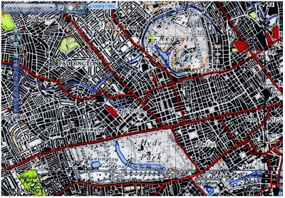
4) The Out of Copyright Map is a 1940's map of Great Britain that is used as a reference to create and verify new mapping. Since this map is out of copyright, our users are allowed to use this data freely for our purposes.


No comments:
Post a Comment