Step 1: Identify area with no data
Search for the area that you want to create mapping for.

Step 2: Create data
Digitise data by using the editing toolbar. This data will immediately appear in point, line and polygon form.

Step 3: Unverified layer
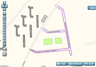
You will notice that the road you created will appear in the unverified map layer with a purple border. This indicates that the new or edited road has been marked as unverified.
Step 4: Verified layer
This unverified road layer will be exported and validated by a verification process. If the road passes this process, the purple border will be removed and the feature will appear in the People’s Map Layer (Verified). The verification process is undertaken on a weekly basis.


No comments:
Post a Comment